Aberdeen Maps and Orientation
(Aberdeen, Scotland, UK)
The city of Aberdeen lies on the east coast of
Scotland and is built on a series of hills with its centre on Castle Hill, St. Catherine's Hill and Windmill Hill, the sites of the original settlement and present day Old Aberdeen.
The River Dee and River Don enclose the city, as well as its ancient harbour and port. Backing the city are the Cairngorm Mountains and to the north-east are the Highlands, the ancient home of the most traditional of the Scottish clans.
Many smaller towns and villages surround Aberdeen city, set in open countryside and being mainly agricultural in origin. Granite outcrops to the north-east of the city provided the building material for its grand and not so grand homes and mansions for over 200 years, until 1971, when the quarries finally closed and concrete took over. On the northern coast of Aberdeenshire's peninsula is the Moray Firth, with its spectacular deep inlets carving into the highland scenery, and to the south-west is the city of
Dundee.
Maps and Orientation of the City
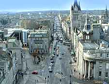
Historically Aberdeen evolved as two distinct districts, Old Aberdeen - close to the harbour and the site of the original ancient town, and New Aberdeen - home to more recent developments. The centre of the city is Union Street, a broad boulevard lined with attractive but modernised 19th-century buildings. Union Street runs for a mile and joins Castle Street at the beginning of Old Aberdeen. Of note, several important districts including the Royal Burghs of Woodside and Thorry lie on the southern bank of the Dee.
The city has a somewhat confusingly random layout in both sectors, but comprehensive pedestrian maps are available at many places of interest. These maps also give details of buses travelling between sites of interest and mark the bus stops. The city's main shopping areas are in its centre, along Union Street, and around the university in Old Aberdeen, with its breathtaking medieval King's College buildings.
- Aboyne - 48 km / 30 miles (50 minutes, west)
- Braemar - 91 km / 57 miles (one hour and 30 minutes, west)
- Burghead - 117 km / 73 miles (two hours, north-west)
- Cruden Bay - 38 km / 24 miles (40 minutes, north)
- Dufftown - 83 km / 52 miles (one hour and 25 minutes, north-west)
- Dundee - 104 km / 65 miles (one hour and 40 minutes, south-west)
- Edinburgh - 203 km / 127 miles (three hours, south-west)
- Ellon - 27 km / 17 miles (30 minutes, north)
- Fraserburgh - 68 km / 42 miles (one hour and five minutes, north)
- Glasgow - 233 miles / 145 miles (three hours and 30 minutes, south-west)
- Inverness - 166 km / 104 miles (two hours and 50 minutes, west)
- Montrose - 61 km / 38 miles (one hour and five minutes, south-west)
- Oldmeldrum - 27 km / 17 miles (30 minutes, north-west)
- Peterhead - 51 km / 32 miles (55 minutes, north)
- St. Andrews - 125 km / 78 miles (two hours, south)
- Stirling - 196 km / 122 miles (three hours, south-west)
- Stonehaven - 24 km / 15 miles (30 minutes, south)
Map of the United Kingdom

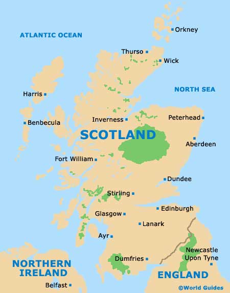
Map of Scotland
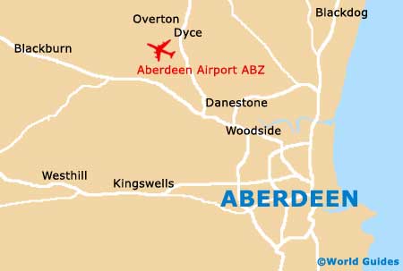
Map of Aberdeen